Map Collection
The Map collection of the Ibero-Amerikanisches Institut (IAI) contains a wide range of map material, from topographical maps, thematic maps (e.g. geology, roads, land use, settlement, languages, borders, botany), city maps, road maps to historical maps as originals and facsimiles. The collection is not only very diverse and of great historical significance, it also offers map material from all the countries of Latin America, the Caribbean and the Iberian Peninsula. The current collection comprises around 76,700 maps (including 1,535 atlases). All maps and atlases acquired since 1997 are listed in the IAI online catalog (external link, opens in a new window). Maps and atlases acquired before 1997 can be found in the card catalog in the IAI's map reading room. The IAI regularly makes its maps accessible to the interested public in exhibitions.
The Staatsbibliothek zu Berlin (SBB) also holds cartographic material on Latin America, the Caribbean, Spain, and Portugal. As a starting point for searching the SBB's holdings, you can use the SBB Maps website (external link, opens in a new window) and the list of topographic maps in the SBB's holdings (external link, opens in a new window).
Historical maps
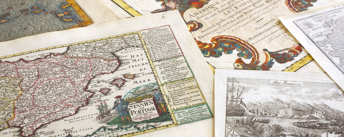
The approximately 2,420 historical maps from the period up to 1850 as well as the facsimile editions of maps and atlases from the period from 1525 to 1850 are of outstanding importance. These are mainly topographical representations of individual regions and countries, corresponding to the historical state of cartographic knowledge, but also views and plans of individual cities. The focus is on overall representations of Central and South America, the Caribbean and the Iberian Peninsula. As part of a project funded by the Deutsche Forschungsgemeinschaft (DFG; German Research Foundation), these holdings were formally indexed and digitized. The digital copies are available both via the IAI online catalog (external link, opens in a new window) and the IKAR old map database.
Topographic map series
The Ibero-Amerikanisches Institut (IAI) owns an extensive collection of topographic maps ranging in scale from 1:5,000 to 1:10,000,000, some of which are listed in the IAI online catalog (external link, opens in a new window).
Historical fortress plans from Spain and Portugal
The mostly colored hand drawings of Spanish and Portuguese fortifications, including some drawings by the Italian military engineer Lorenzo Possi, are unique documents of the military history of the Iberian Peninsula during the 17th century. The map collection contains 34 plans from the period 1665-1676.
Conditions and contact
Conditions of use
Folded maps and smaller atlases (up to format 4°) can be borrowed as long as they are in good condition. All other map materials can be consulted in the IAI's map reading room. To request the desired materials, you must submit an application for use and make an appointment.
Reproductions can be made for scientific and cultural purposes upon written request. However, this is only possible for materials for which the IAI holds the copyright or which are in the public domain. Likewise, there must be no reasons of preservation to prevent this. The request for scans is available here.
Consultation hours
Monday: 2 - 4 p.m.
Tuesday: 10 a.m. - 12 p.m.
Wednesday: 3 - 5 p.m.
Thursday: 10 a.m. - 12 p.m.
Friday: 10 a.m. - 12 p.m.
Contact us
-
Caterina Indolfo
- Working area:
- Special Collections
- Map Collection / Poster Collection / Art Prints and Illustrations Archive / Newspaper Clippings Collection
- E-Mail: colecciones(at)iai.spk-berlin.de (opens your email program)
- Tel: +49 30 266 45 3131 (starts a telephone call, if your device allows this)
- Working area:
-
Daniela Rokoß-Heiß
- Working area:
- Special Collections
- Map Collection / Poster Collection / Art Prints and Illustrations Archive / Newspaper Clippings Collection
- E-Mail: colecciones(at)iai.spk-berlin.de (opens your email program)
- Tel: +49 30 266 45 2170 (starts a telephone call, if your device allows this)
- Working area: